Via Grischuna: An Alpine Trail Running Odyssey in Grisons
The Via Grischuna, spanning seven exhilarating stages from Davos to St. Moritz, offers an adventure that reaches for the skies, ascending approximately 9,000 meters in altitude. Grisons, with its colossal mountains and awe-inspiring landscapes, needs no introduction. Its wide valleys, rocky terrain, pristine lakes, and gleaming glaciers together create a natural masterpiece.
Key Highlights:
- Trail Runner’s Challenge: The Via Grischuna is a trail runner’s dream and a test of endurance. With each of the seven stages demanding over 1,000 meters of elevation gain, this trail will push your limits. Prepare for steep ascents, challenging descents, and alpine terrain that requires sure-footedness and experience.
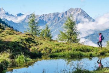
- Immersive Natural Beauty: Traverse wild and romantic landscapes that will leave you in awe. Grisons’ mountain world is a testament to untamed beauty, offering wide valleys, rocky challenges, clear lakes, and majestic glaciers. Every step is an encounter with nature’s grandeur.
- A Pilgrimage Through Nature: The Via Grischuna is not just a trail run; it’s a pilgrimage through some of Earth’s most stunning landscapes. The heart-pounding ascents and thrilling descents are balanced by the pristine beauty of Grisons. This adventure will etch an indelible mark on your trail-running soul, offering a test of limits and a reward of unparalleled natural splendor.
For trail runners seeking an alpine challenge that combines endurance with the splendor of Grisons’ alpine world, Via Grischuna eagerly awaits your footprints.
| Start | July to September | |||||||
| Time of departure | Flexible | |||||||
| INCLUDED IN THE PRICE |
|
|||||||
| NOT INCLUDED IN THE PRICE |
|
*This tour is based on a minimum of two participants. Only the services mentioned above are included in the price.
Additional information
| Month | August, July, September |
|---|
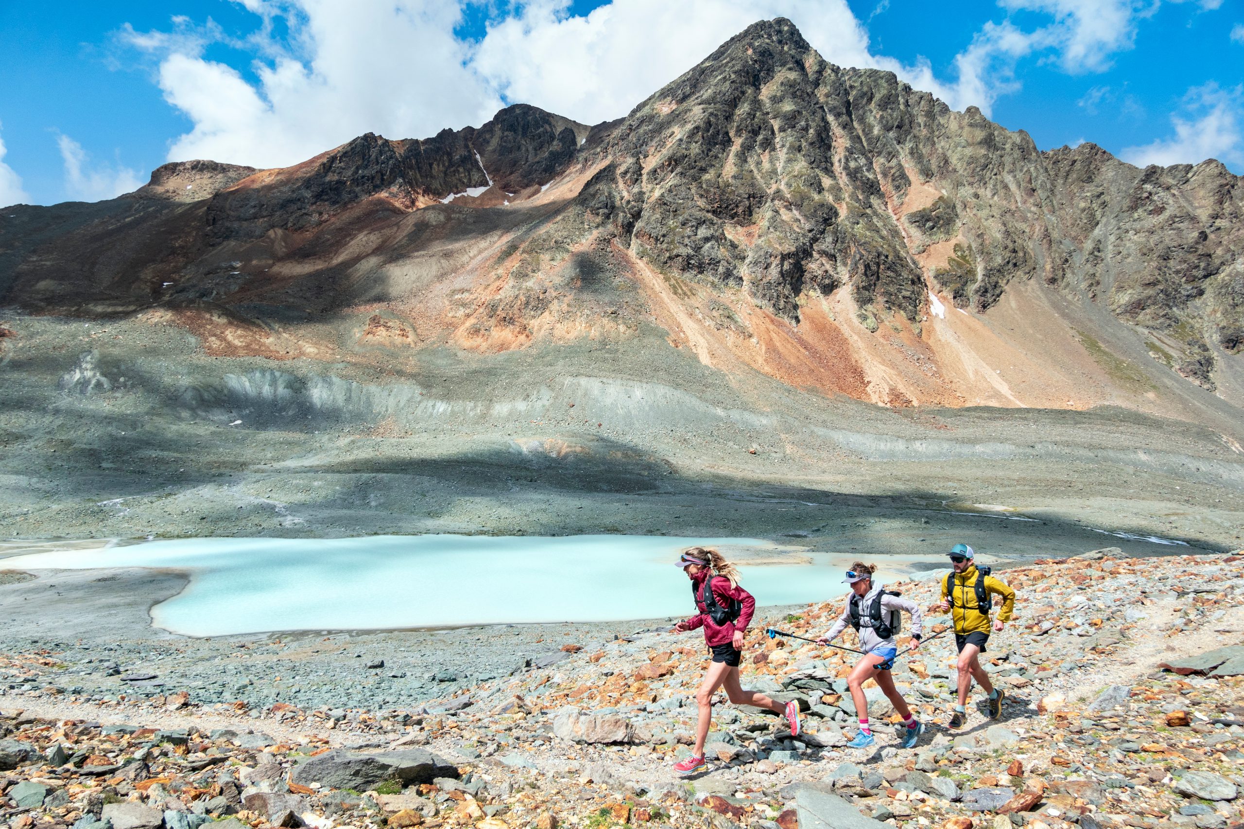
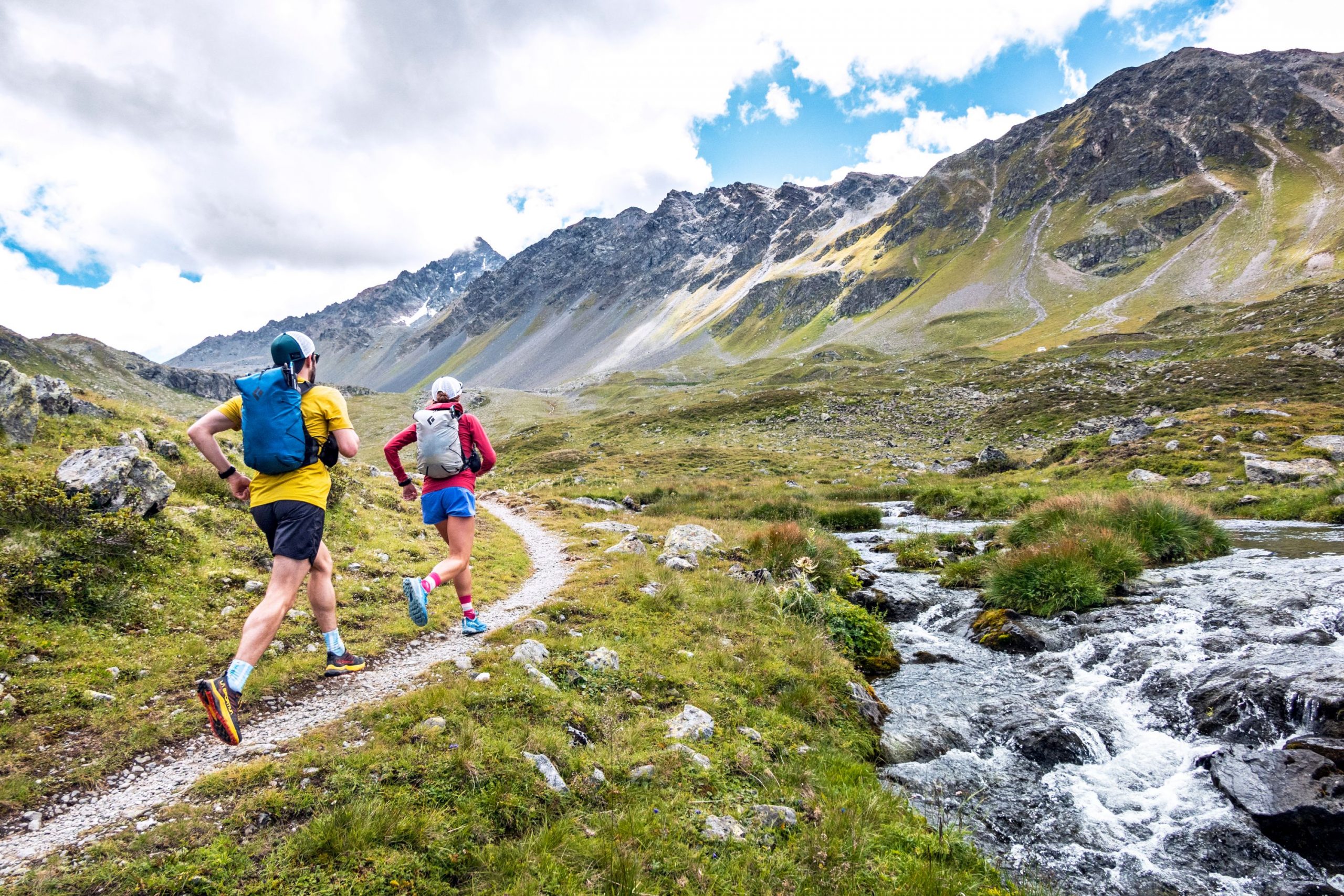
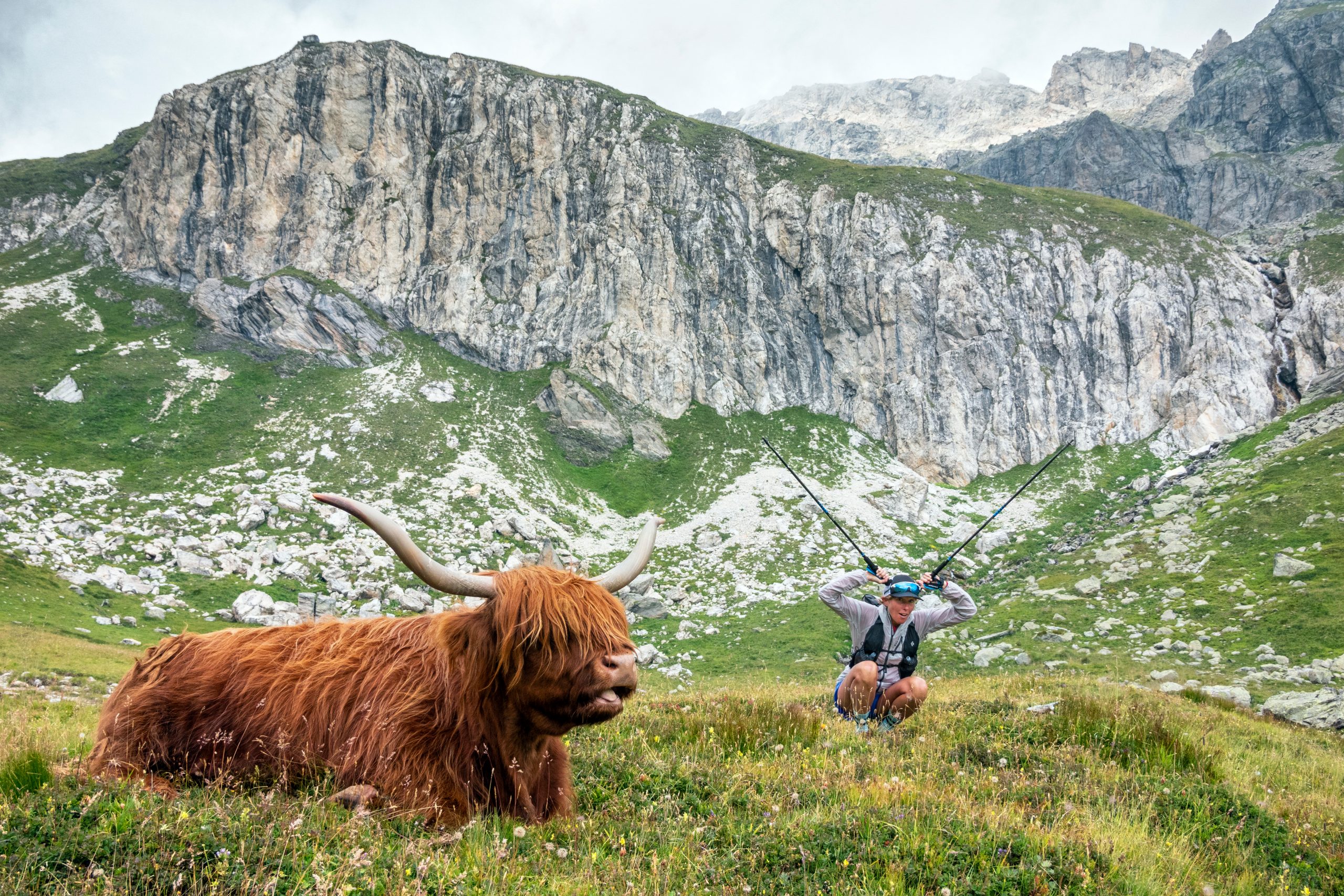
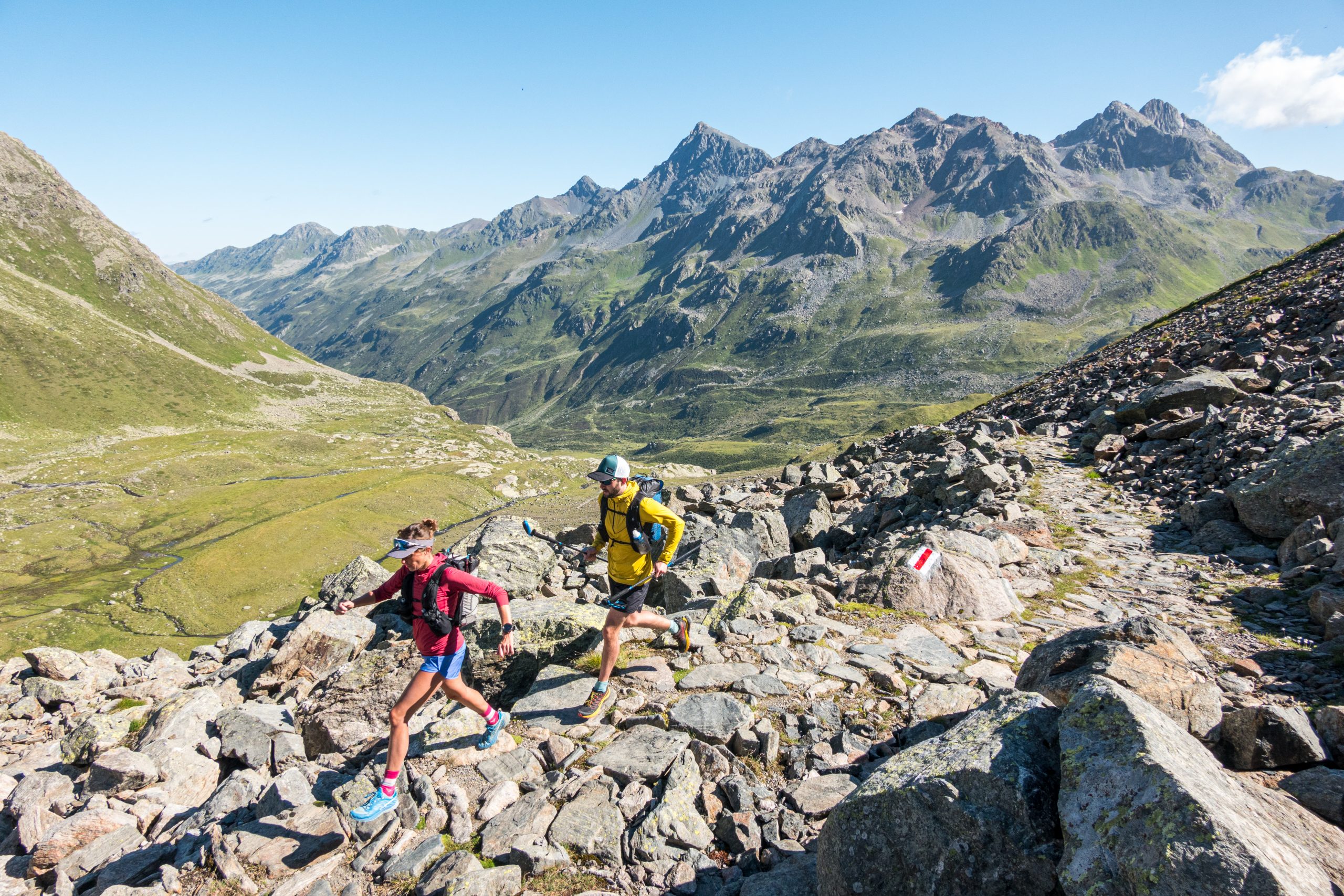
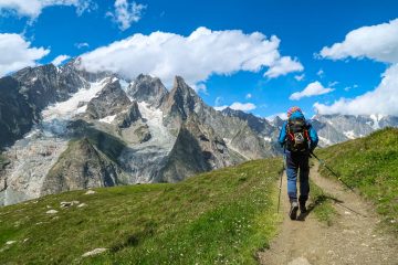
Via Grischuna
This is an example of Via Grischuna.
Via Grischuna, a seven-stage trail running adventure, explores Grisons’ alpine majesty. With steep ascents and descents, this trail pushes limits, offering breathtaking landscapes of valleys, rocky terrain, lakes, and glaciers. A pilgrimage through untamed beauty awaits, promising an indelible mark on every trail runner’s soul.
Data:
Total distance: 156-169 km
H+: 9300-9820 m
H-: 9050-10030 m
Level: Advanced
Arrival to Klosters | Vereina – Dürrboden
Luggage drop-off in Klosters and then with the call-bus to the Vereina mountain inn. At the beginning, it’s a cosy walk over lush green pastures, but already the first ascent to the Jöri lakes is a real challenge. Highlights of today are the two passes Jöriflüelafurgga and Flüela Pass. From here, you descend to the mountain inn in Dürrboden.
Data:
Length: 23 km
Duration: 4-7 hours
H+: 1550 m
H-: 1485 m
Dürrboden – Bergün
With the ascent to the Scaletta Pass, you overcome about half of the difference in altitude of today’s stage right at the beginning. Then you keep the altitude and walk high above the Val Funtauna to the crystal-clear mountain lakes of Sella da Ravais-ch. A wide valley leads you to Chants. Those with tired legs can shorten the trip from here with the Taxi Alpin – for fit runners, the plateau above Val Tuors offers a harmonious end to today.
Data:
Length: 16.5 – 29.5 km
Duration: 4-8 hours
H+: 800 – 1370 m
H-: 965 – 2010 m
Bergün – Spinas
The first kilometres lead along the Albula line past the lakes Lai da Palpuogna and Lais digl Crap Alv, then you descend in serpentines into Val Bever. The turquoise-blue river Beverin accompanies you on the last kilometres to the mountain inn in Spinas.
Data:
Length: 18 km
Duration: 4-6 hours
H+: 1295 m
H-: 845 m
Day 4: Spinas – Bivio
The trail to the Chamanna Jenatsch climbs steadily at first, and the last few metres up to the highest SAC hut in Grisons are a real challenge. The views on the Fuorcla d’Agnel and Fuorcla digl Leget passes are breathtaking. A long trail leads you from here down to Bivio.
Data:
Length: 27 km
Duration: 6-8 hours
Height +: 1655 m
Height-: 1700 m
Bivio – Silvaplana
An old Roman mule track leads you up to the Septimer Pass. From here, you set off for the summit climb, which takes you high up onto Piz Lunghin. Afterwards, you descend into the Engadine. You reach the Via Engiadina and cross the Heidi village Grevasalvas. Today’s destination: Silvaplana.
Data:
Length: 26 km
Duration: 5-7 hours
H+: 1560 m
H-: 1520 m
Silvaplana – Pontresina
The trail winds upwards through the forest in countless serpentines. Once you have crossed the tree line, views of the lakes of the Upper Engadine await you. The highlight of today is the Fuorcla Surlej with a breathtaking panorama of the glaciers of the Bernina Group. A steep descent is followed by a gentle finish through the Val Roseg to Pontresina.
Data:
Length: 23 km
Duration: 3-6 hours
H+: 1190 m
H-: 1235 m
Pontresina – St. Moritz
First up to Alp Languard and then in a long curve on a high trail to the Segantini Hut. This is followed by a steep descent through Val Muragl and an unhurried cool down walk through the Stazer Forest to St. Moritz.
Data:
Length: 22.5 km
Duration: 4-6 hours
H+: 1200 m
H-: 1235 m
Departure
Departure or extension
Arrival by public transport to Klosters. For direct arrival: Suitcases must be handed in at the luggage counter by 10:00 a.m. at the latest.
Departure by public transport from St. Moritz.


Tour Reviews
There are no reviews yet.
Leave a Review