- Clásico
- Experimentado
- Grupos
- Grupo guiado
- Choza a choza
- Mont Blanc
- grupo privado
- Autoguiado
- Verano
- carrera de montaña
Running Tour Mont Blanc: ¡Conquista el legendario UTMB en siete días!
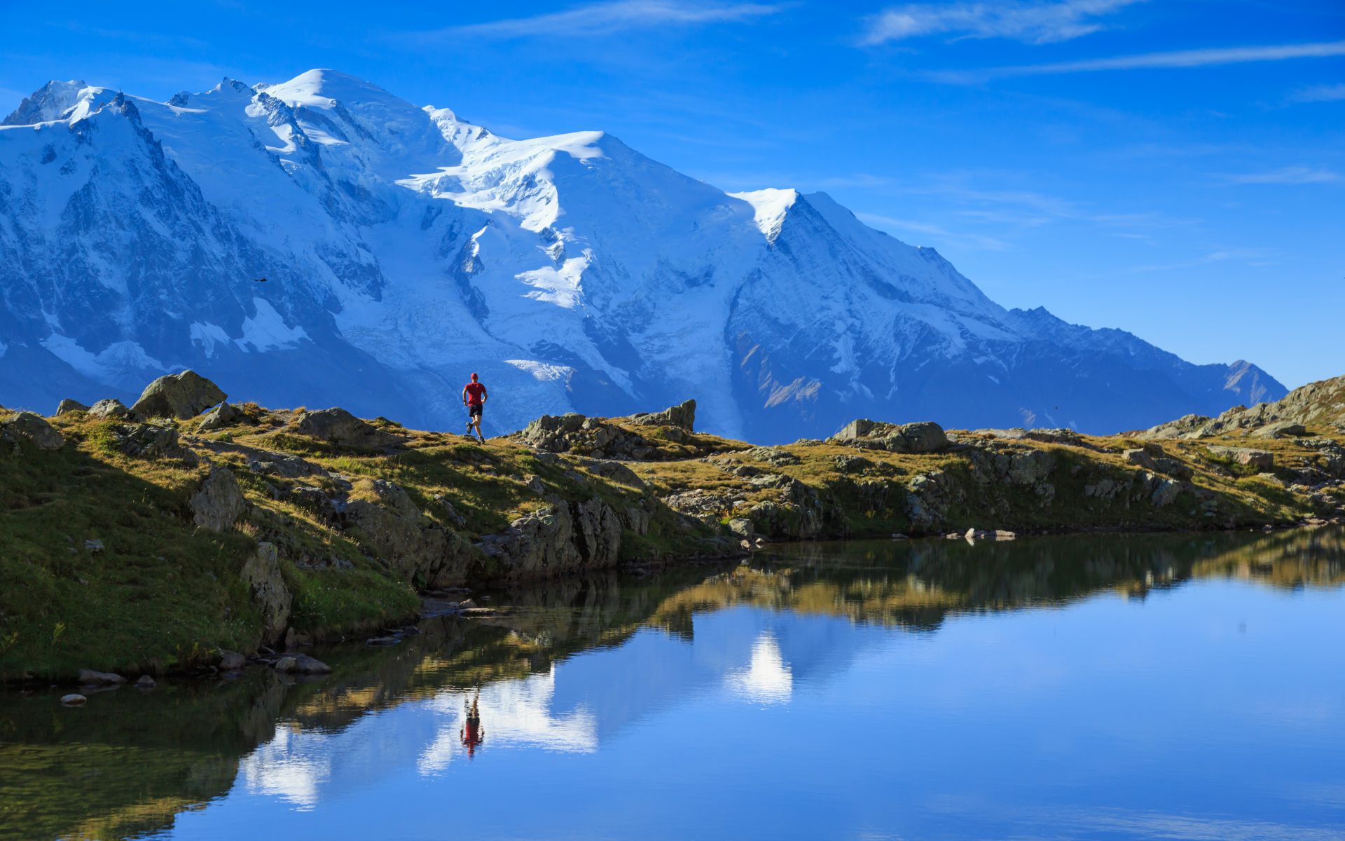
¿Estás listo para una extraordinaria aventura de trail running a lo largo de una de las rutas de senderismo más emblemáticas de Europa? El Tour Mont Blanc, famoso por sus impresionantes paisajes y desafiantes senderos, sirve como escenario perfecto para este viaje a pie. Siga los pasos de los legendarios participantes del Ultra Trail du Mont Blanc (UTMB) mientras recorremos todo el circuito de 170 km, conquistando aproximadamente 10,000 metros de desnivel durante seis días llenos de acción. Estarás rodeando el imponente Mont Blanc, la montaña más alta de Europa, y la experiencia promete ser diferente a cualquier otra. Nuestro recorrido parte de la pintoresca ciudad italiana de Courmayeur, que ofrece un punto de vista único para la aventura que nos espera.
Puntos destacados del recorrido:
- Courmayeur Salida: Comenzamos nuestra aventura en Courmayeur, Italia, brindando una perspectiva inicial distinta del Mont Blanc. Su viaje de carrera comienza y concluye en el lado italiano de esta impresionante montaña, que ofrece un ángulo diferente de su magnificencia en comparación con los típicos puntos de partida.
- Alojamiento en albergue: Descanse y rejuvenezca en cómodos albergues a lo largo de la ruta. Puedes contar con una buena noche de sueño y un abundante desayuno para prepararte para cada día de carrera. Estos alojamientos ofrecen un ambiente acogedor y la oportunidad de conectarse con otros corredores, compartir historias y experiencias.
- Escenario espectacular: A lo largo de este recorrido, prepárese para quedar hechizado por los impresionantes paisajes del circuito del Mont Blanc. Recorre los senderos en compañía de un pequeño grupo internacional de compañeros corredores que comparten tu pasión por la exploración y la emoción de correr en uno de los entornos más extraordinarios de Europa.
Disponibilidad del Tour:
Tenga en cuenta que este recorrido requiere un mínimo de cuatro participantes para continuar, lo que garantiza que tendrá un grupo con quien compartir sus aventuras. No pierda la oportunidad de embarcarse en un viaje extraordinario por el Mont Blanc y descubrir los increíbles paisajes y desafíos que tiene para ofrecer.
| PUNTO DE ENCUENTRO | Courmayeur frente al Hotel Croux | |||||||
| TIEMPO | Lunes 9.00 a.m. | |||||||
| INCLUIDO EN EL PRECIO |
|
|||||||
| NO INCLUIDO EN EL PRECIO |
|
Información adicional
| Mes | agosto, julio, septiembre |
|---|
Día 1
Distancia 31 km (+2700/-2300)
Dia 2
Courmayeur 1220 m. – Inicio del recorrido de trail running del Mont Blanc hasta el refugio de Bertone
1977 m. – Refugio de montaña Bonatti 2026 m. – Arnouva 1770 m. – Refugio Elena 2062 m. –
Col del Gran Ferret 2537 m. – La Fouli 1593 m. – Champex 1466 m.
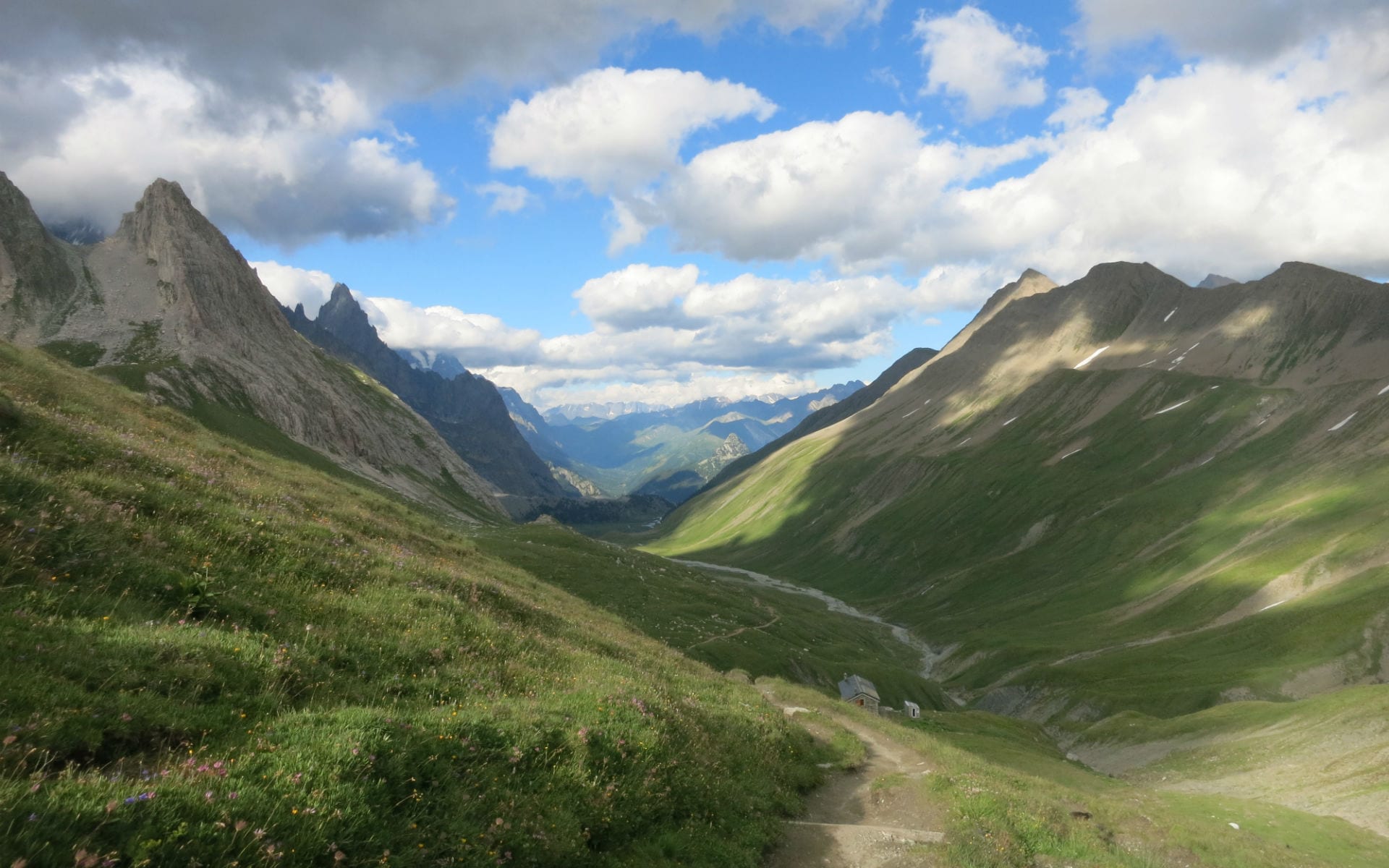
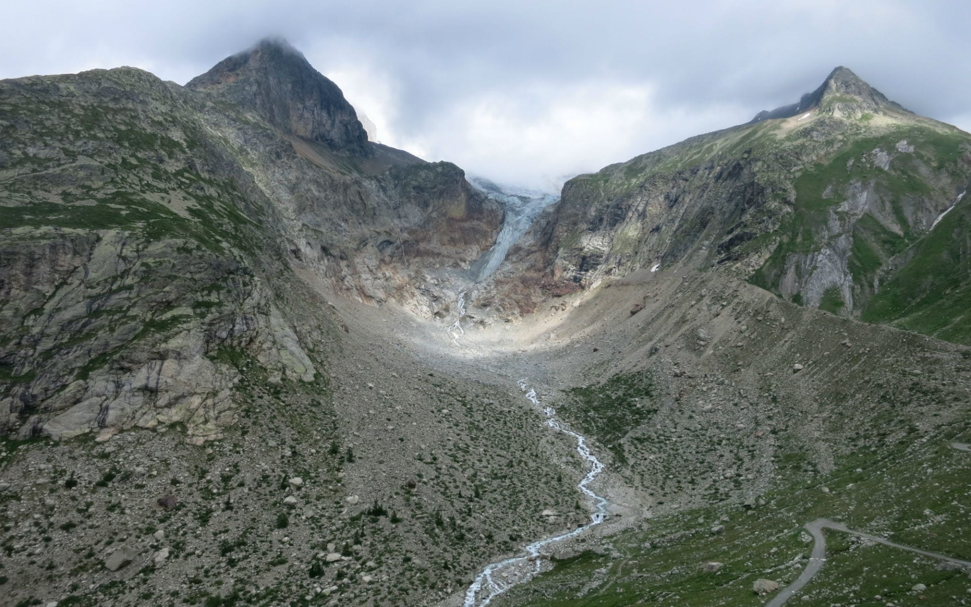
El primer día de caminata comienza en el exuberante Val Ferret, debajo de los picos de Gran Jorasses, con el sendero que conduce al paso de Gran Ferret, frente al glaciar Triolet. El descenso en Suiza se realiza por un bonito sendero rodeado de prados hasta llegar al pequeño pueblo de La Fouly.
Distancia: 48 kilómetros
M+: 2500
M-: 2100
Relais d'Arpette / Hotel du Glacier / Gite Bon Abri / Hotel Mont Lac
Alojamiento en habitación doble
Comidas: Desayuno, Cena
Día 3
Sendero desde Champex 1466m. en la Fenetre d'Arpette 2665 m. – Bisse du Trient 1583
metro. – Refugio de montaña Les Grands 2113 m. – Col del Balme 2191 m. – Le Tour 1400 m. – Autobús a
Chamonix 1030m.
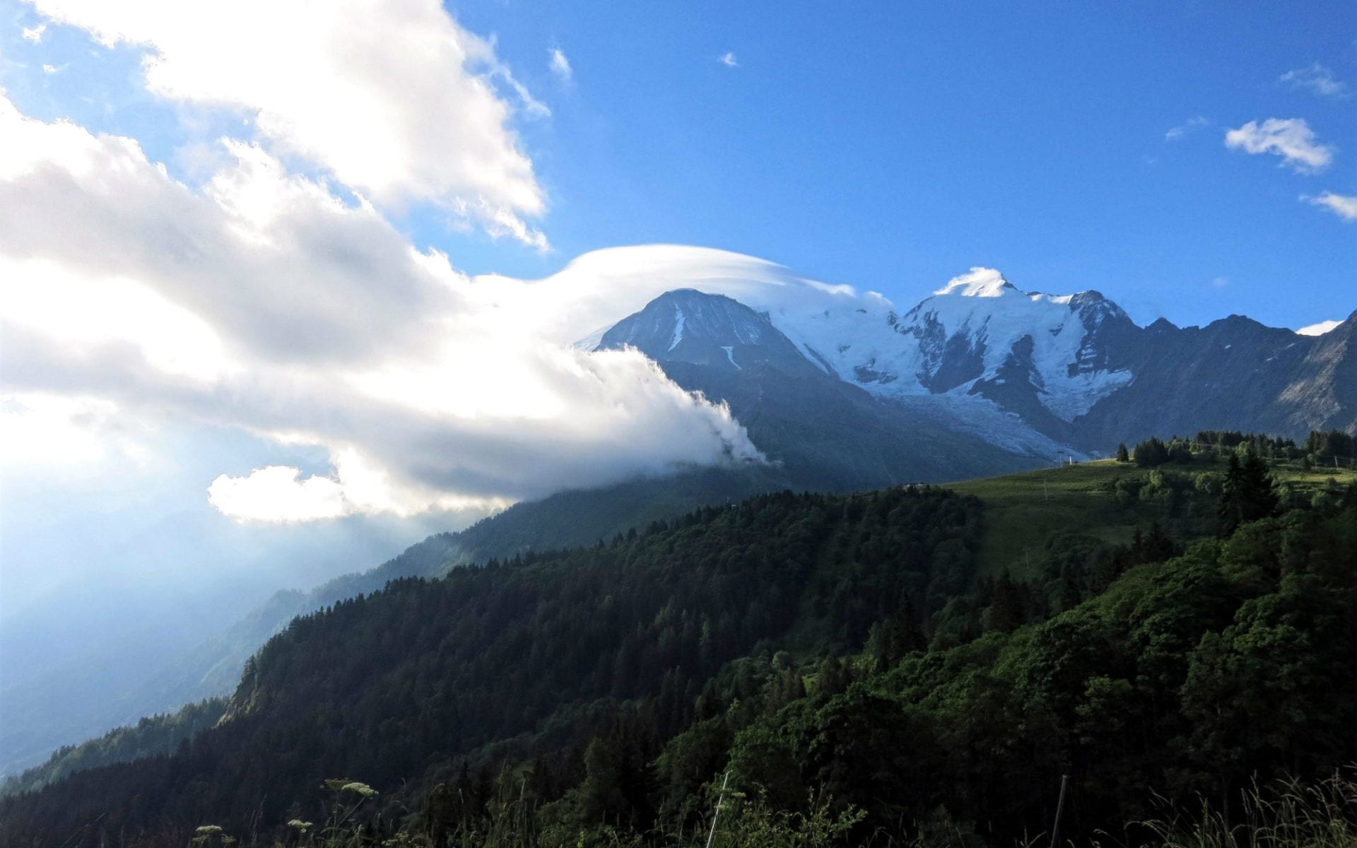
Desde Champex Lac llegarás a Trient cruzando el paso más fácil de Bovine o por la exigente Fenetre d'Arpette, frente al glaciar de Trient y entre increíbles torres rocosas. Con una caminata larga pero regular hasta el puerto y refugio Col du Balme, ¡desde donde se despliega la vista del Mont Blanc! ¡El descenso por el valle de Chamonix con las vistas de la Aiguille du Tour y la iguille Verte es increíble!
Distancia: 20 kilómetros
M+: 1700
M-: 1800
Hotel Vallée Blanche / Hotel Croix Blanche / L'Oustalet / Hotel le Prieuré
Doble habitacion
Comidas: Desayuno
Día 4
Desde Chamonix autobús hasta Argentiere 1320 m., sendero hasta Tete Aux Vents 2132 m. – Refugio de montaña Lac Blanc 2352 m., – La Flegere 1877 m. – Chamonix 1030m.
¡Hoy explorarás el lado oeste del valle de Chamonix, llegando al Refugio del Lac Blanc, uno de los lugares más bellos del circuito, frente a todas las cumbres de la historia del montañismo! Un buen momento para visitar también el pueblo de Chamonix, un vibrante centro alpino.
Distancia: 16 kilómetros
M+: 1100
M-: 1300
Hotel Vallée Blanche / Hotel Croix Blanche / L'Oustalet / Hotel le Prieuré
Doble habitacion
Comidas: Desayuno
Dia 5
Sendero desde Chamonix 1030m. en Les Houches 1000 m. – Bellevue 1800 m., Col.
Punto 2120 m. – Refugio de montaña De Miage 1559 m. – Refugio de montaña Du Truc (1720 m. – Les Contamines Montjoie 1162 m.
El largo sendero de hoy cruza prados, ríos y bosques debajo de la Dome du Goutier y la Aiguille de Bionassay, conduciendo al panorámico Col Tricot y luego al prístino valle debajo del Glaciar du Miage, llegando finalmente al pueblo de Les Contamines Montjoie.
Distancia: 25 kilómetros
M+: 1600
M-: 1500
Camping le Pontet / Casa rural les Melezes / Hotel la Chemenaz
Doble habitacion
Comidas: Desayuno
Día 6
Trek Refugio de Nant Borrant (1525 m.) – Refugio de montaña De la Balme 1706 m. – Col de la Croix du Bonhomme 2483 m. – Les Chapieux 1560 m. – Traslado privado a Bourg Saint Maurice 830m.
Un largo día recompensado con increíbles vistas y un hermoso entorno. Desde Les Contamines, el sendero sube por el valle hasta el collado de la Crux de Bonhomme, desde donde el descenso a través de prados y pastos conduce a Les Chapieux. Un traslado privado lo llevará a Bourg S. Maurice.
Distancia: 19 kilómetros
M+: 1400
M-: 1000
Alojamiento en el campamento base
Doble habitacion
Comidas: Desayuno
Día 7
Traslado privado a Ville des Glaciers 1789 m. – Sendero hasta el refugio de montaña Des Mottets 1870 m. – Col de la Seigne 2510 m. – Refugio de montaña Elisabetta 2197 m. – La Visaille 1659 m. – Courmayeur 1220 m. – Salida El último día del circuito te llevará de regreso a Italia, cruzando uno de los pasos más bellos del recorrido y conduciendo a Val Veny, donde la afilada Aiguille Noire aparece en toda su majestuosidad. El descenso de regreso a Courmayeur pasará por Rifugio Elisabetta, debajo de las Aiguilles de Trelatete y cerca de los enormes glaciares de Miage.
Distancia: 16 kilómetros
M+: 800
M-: 900
Aeropuerto más cercano: Turín/Malpensa/Ginebra
Estación de tren más cercana: Aosta/Chamonix